Both of us gals are up before the sun rises and if it were daylight out we would be on our way…but we wait till there is adequate light to see before hitting the roads. Instead of attempting to walk our bikes back down the steep gravel hill that we had encountered the day before, we found a nearby bike path called the Old Carriage Trail that led us right back to the OTET. Being in the Cuyahoga Valley, there are many ravines and this trail was no exception. While experienced Linda rode slowly down the steep hill, I chose to walk my bike down!
The Ohio to Erie Canal, which we travel beside, began its construction during the 1820’s and early 1830’s. The canal initially provided a connection between Akron and Lake Erie at Cleveland then extending all the way to the Ohio River at Portsmouth within a few years. Later, connecting canal systems were built connecting it to the Pennsylvania and Ohio Canal and other parts of Eastern Ohio.
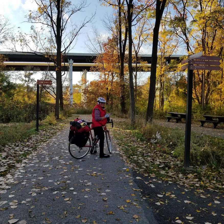
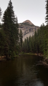
Stopping for some photos at the Boston Mill Visitor Center just north of the 241m, toll highway…the Ohio Turnpike in Peninsula, Ohio.
Polluted from years of industrial waste, the Cuyahoga River between Akron and Cleveland was dangerously dirtied by a century of dumped factory waste and sewage from cities. In the summer of 1969 a floating pile of oil-soaked logs and other trash caught fire on the river in Cleveland. The Cuyahoga River became known as the river that burned.
Major cleanup was initiated and now this 84.9m free flowing river, is being restored, revitalized and protected. From Cleveland to Akron, we are able to view this beautiful river as we ride beside her, eventually crossing over and turning away from this river just north of Akron.
Szalay’s Sweet Corn Farm & Market is just a quick jump off of the Canal Towpath in Peninsula, Ohio. Linda was anticipating apple juice to quench her thirst but alas…they did not have any.
Riding into Akron, we met Mr Brown as he headed north to Cleveland. His trek began in Cincinnati and biking to Cleveland, he will then turn around and yo-yo back to Dayton, Ohio. Notice the cup/mug attached to a front bag. He had gear strapped everywhere!
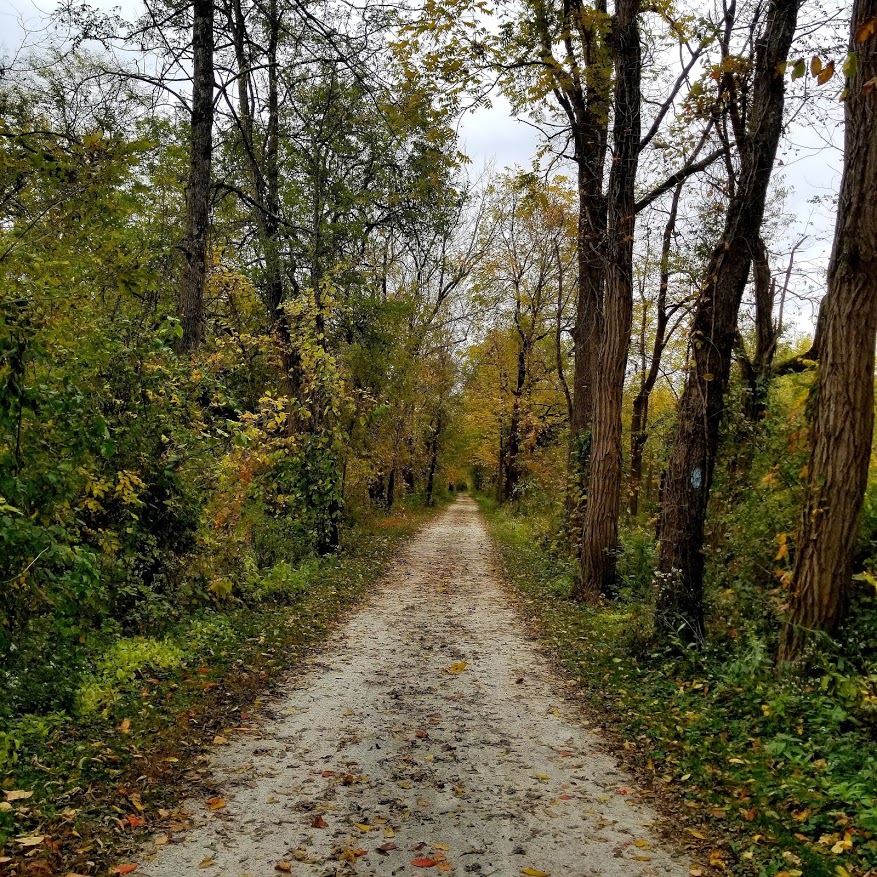
The blue blazed Buckeye Trail which loops around the state of Ohio for 1,444m, can be seen and shared for short distances.
Still learning to properly use my bike gears, understanding the mechanics of it and riding with 30 pounds of gear, our destination for Day 2 was a near 50m ride to Massillon, Ohio. Here we tented at the Rivers Edge Campground on the towpath.
Enjoying every bump and bounce down the Ohio to Erie,
Arriving at Linda’s home at 6:45am, we quickly made changes, included add ons and finalized any adjustments to my bicycle. Clamping on a rear view mirror, a phone holder and a bottle cage, making sure I had rain protection for my bike seat and phone, then removing the front and back lights on my bike for the shuttle ride to Lake Erie, we were nearing completion. Linda had graciously given me two pair of bike shorts and a pair of bike shoes to wear, amongst numerous tools, etc. and by the time 8:00am rolled around, when our shuttle driver arrived, we were set and ready to go!
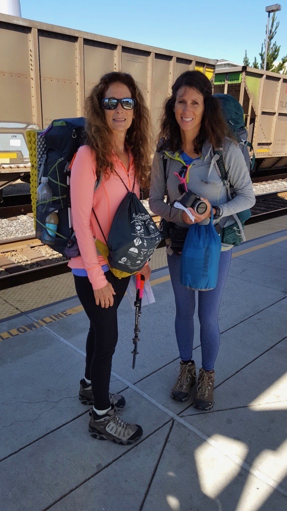
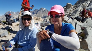
Meet Linda, my biking partner…long time rider of motorcycles, bicycles and trikes.
This ride was filled with many “First’s” for me. First time I have bike packed and carried adequate gear to sustain myself for the duration on our trip. First time to bike over 40 miles in a day, first time to ride through towns and on roads, fist time to ride through rain, first time to learn bike communication and skills. I was ready and up for the challenge!
I met Linda, my bike partner, on a White Mountains Women’s Retreat several years back. She is full of life, adventure and bicycle knowledge. Due to the Covid virus, any bike maintenance class that I had signed up for was canceled…having Linda ride with me was a reassurance of learning those needed skills.
Our shuttle driver from Ohio Trail Shuttle, arrived promptly at 8:00am. We loaded our panniers and gear into his vehicle, securely strapped our bikes to the back, and for several hours made our way to the northern terminus of the OTET on the shores of Lake Erie.
Arriving around noon, we quickly geared up, took some pictures, looked at the map and off we rode…our destination for the day was to a friends home who graciously offered her home for the night. Our first half day was complete with maneuvering through Cleveland, taking in the views and making our way to the Ohio to Erie Canal Towpath and the Cuyahoga Valley.
Our jump off point for the night was near the Station Road Bridge. A large gravel road that led straight uphill. It required that we both dismount our bikes to walk up, and up, and up…till we reached Route 82.
I’m a backpacker at heart and the two things that I quickly realized as a biker was…1) taking pictures of all the historical, scenic and beautiful sights was not going to be possible as I zoomed past it all, and 2) carrying a backpack on my back is a lot lighter than pushing my bike full of gear up a steep hill!
“I want to see what’s on the other side of the hill and then what’s beyond that.” Emma “Grandma” Gatewood
The desire to explore and experience life to it’s fullness is embedded within each of us…to live a life that is rich with memories of building relationships, seeking adventure, all while soaking in the beauty that surrounds us, reaching a goal and pursuing a dream is what A Time To Keep specializes in. We will help to plan, organize and execute your next hike or backpacking trip for you and your family, for your friends, co-workers, women’s group, home-school club or as a solo trip planned just for you with our guides…
These Boots Are Made for Walkin’ sung by Nancy Sinatra ranked number 22 of The Top 40 Songs…color television sets became popular, the Vietnam War was raging, and Pampers made their first disposable diaper. Dr. Seuss’ “How the Grinch Stole Christmas” the animated television special adapted from the book is shown for first time on CBS. Lyndon B Johnson was our President…Mini Skirts, Miranda Rights, Batman, Star Trek the Mamas and the Papas, to this day, fifty years later are still popular, recognized and hold significance to many. The Sound Of Music won several Oscars at the Academy Awards, and for the first time, all cigarette packetsin the US must carry the health warning “Caution! Cigarette smoking may be hazardous to your health”…t’was The Year of 1966.
We lived in a small suburban town just north of Dayton, Ohio known as Huber Heights which boasted a 1970 Census of Population of 18,943. We had numerous friends that lined the streets in both directions. School was within walking distance and as I entered the fifth grade I had my first male teacher…Mr Bennett. It was a year of change, a time of growing up, it was a season of new. New town, new home, new school, new neighbors…and on October 22nd…a new baby was born into our family, a new baby named Cheryl Ann. Being the oldest sister, I had the privilege of holding this tiny baby gently in my arms during the wee hours of the night as mom prepared her bottle…and the years began to roll onward. By the time I had become a teenager, the youngest of five siblings was nearing her fourth birthday. Age differences, growing up in the 70’s…the years continued to roll onward and away and as Cheryl Ann continued to brighten our lives, at the young age of eleven…I was getting married.
In the early 80’s, as I was raising three little girls she was attending high school and dreaming of some day attending an Art College. We have connected more recently during our adult years, from Glamping at Camp Kern, hiking and camping together at our local MetroParks, taking a trip to visit spectacular Alaska, taking her on her first backpacking excursion to the Red River Gorge and more recently backpacked the John Muir Trail together.
I adore my younger sister. A sister delightfully full of laughter, who is exceptionally artistic and creative. A devoted wife, loving mother of four and a woman with a compassionate heart for little orphan children. Cheryl Ann is a photographer, soccer referee, yoga enthusiast, dog lover, hiker and a backpacker. She has backpacked Indiana’s Knobstone Trail, the trails of Ohio in Shawnee State Park and the John Muir Trail of the Sierra Nevada Mountains of California. This year she embarks on another journey, a journey with the promise of adventure and challenge, testing her physical and mental strengths and weaknesses. With the demanding tasks of endurance, her body will grow weary and fatigued as she hikes northbound from Georgia to Maine on the Appalachian Trail. For the next several months she will introduce herself as “Tiger Lily”, her trail name. As she climbs the eastern Appalachian Mountain chain towards the state of Maine, she will shed fears, at times she will cry from sheer exhaustion, she will meditate and seek God, and her mind will be renewed. She will transform and change and will summit Mt Katahdin…a different woman. A woman who is stronger and more confident with herself and with life. A woman who will shout from the mountain tops with praise and thanksgiving. She will be rewarded with mountain vistas, the newness of spring, and the delight of being alive breathing in the breath of God himself. Of all of the rewards that she will receive…the greatest will be the reward of transformation…
Ezekiel 36:26 “And I will give you a new heart, and a new spirit I will put within you…”
Tiger Lily hikes the Appalachian Trail 2019 with purpose…to raise an awareness and is partnering with UNAFAA International (Unafaa is a Swahili word meaning “You Matter”), to help raise support for orphans and children in Kenya who are in need.
Tiger Lily is seeking to raise funds for these orphans in need. She has a Blog, an Instagram account and a Facebook page in which you can follow her as she hikes northbound to Maine.
Will you join me and other’s as we pray for her safety as she walks 2,192 miles, pray for warmth during the coldest of nights, and a gentle breeze to cool her during the hottest of days…will you join me and other’s with words of encouragement to her as she travels northbound by reaching out to her through her blog, FB or Instagram account…will you also join me and other’s in helping to raise support for these children of Kenya. Will you join me and cheer for her by supporting her efforts…
I am beyond proud of Cheryl Ann…her goals that she has set forth for herself, to plan and prepare for such an endeavor and to become mentally and physically acute for the challenges that lie ahead is quite an undertaking. I am proud to follow her as she treks into the unknown of adventure. I will cheer for her and with her at her successes, encourage her when she feels defeated and pray for her for wisdom, guidance and that the power of the Holy Spirit engulfs her with his comfort, peace and strength…for I am and will be Her Greatest Cheerleader as she hikes the Appalachian Trail…
Her Greatest Cheerleader…Is Me
San Francisco
Spring Grove Arboretum
Carter Caves
Donahue Pass 11,056′
Mather Pass 12,067′
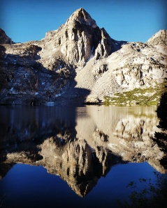
Lyell Canyon
Sunday, July 3rd
Tiger Lily watercolor painting
I chose to hike the John Muir Trail for a very simple reason…I wanted to backpack out on the west coast and in the Sierra Nevada Mountains…
Purple Lake ~ 9,930′ Friday, July 8th, 2016 View from tent site
As I viewed pictures, websites, read blogs and Facebook posts…as I researched, read more and anticipated…and in my simplest gathering of thoughts could I then only begin to truly imagine how I envisioned this trail! I began to get a sense of what the John Muir Trail may look like…I tried to see it through the eyes of others, though their writings, through their experiences and their perspectives. I read quotes and writings from John Muir…what magnificent beauty and grandeur he so passionately wrote about and fought for. I could only imagine through the eyes of others.
Silver Pass 10,740′
I myself needed to testify and witness…to breathe the dry dusty air…to smell the aromas of pine trees and sky pilot wildflowers…to touch and feel the rocks beneath my feet…to stop beside each little morsel of shade as the sun drenched heat of the day promised to conquer our steps…a trail that was going to challenge and test strength…health…endurance and spiritually…I wanted to experience the boldness and power of this trail.
Painted Lady Rae Lakes Kings Canyon National Park
New and unfamiliar words that lined the pages of the Guidebook in an attempt to educate me in the realm of geology…words like: metamorphic and metavolcanic rocks, granodiorite, columnar basalt and pluton formation which all thrown together created a landscape that gives the High Sierra its spectacular array of color, shape and beauty…jagged, sharp, round or smooth…I often questioned the how and why to God’s creation.
Devils Postpile Wednesday, July 6th, 2016 View from the JMT
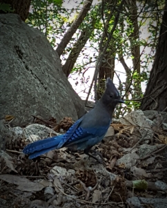
Amongst the rocky mountains, wildflowers lined the trail and sprung up in green lush meadows, flowed out of the tight crevices of rock and produced color in a dry thirsty region. Clear bottomless lakes the color of turquoise…rocks in all shapes and sizes displaying their red, black, grey and pink colors. Wildlife that darted throughout the landscape…and my favorite…the loud but beautiful Steller’s Jay…all of this brought an awe of peacefulness to heart and mind as I hiked southbound toward Mt Whitney.
Steller’s Jay
The High Sierra boast with soaring granite cliffs, peaks towering 13,000 & 14,000 feet…lakes, waterfalls and canyons…yet, with all of this spectacular beauty comes a price that many a hiker must endure if they are to experience this vast wilderness. The unknowing and unforeseen hardships of a trail…
Sun setting on Evolution Lake & Basin
Many a hiker must turn back because they are unable to acclimate to the higher altitudes of the Sierra Nevada. Tiger Lily and I daily were confronted with headaches, nauseated stomachs, dizziness and tiredness. We climbed each mountain pass with a slow pace only to stop on occasion to catch our breath and rest. The dry and dusty altitude and environment caused daily nose bleeds and a dry cough. Deep blue skies with a sun that would cause us to wear long sleeved shirts throughout the day covering necks, hands and arms to keep the sun from burning our skin. Sunscreen, bug spray, Dramamine, ibuprofen and tissue were kept within the side pockets of our packs for repeated use daily. Bug nets to protect the face and neck…backpacks that weighed heavy on the back causing extreme shoulder pain and lower back bruising on Tiger Lily. Packs, sleeping bag, stuff sacks held together with duck tape. Gear that would not perform properly…
Muir Pass Looking for the trail…
Once we arrived at the Muir Trail Ranch and with 112 miles yet to hike…I chose to ship my ball cap back home thus causing my nose and lip to blister and bleed due to wind and sun exposure. I shipped home any bug spray and bug net…many a night we would eat our dinner in the privacy of our tents leaving the mosquitoes out to fight amongst themselves…I shipped home my camera and extra battery charger knowing full well that possibly my phone would not last the duration of the hike. Therefore I do not have any pictures of the last two days…Forester Pass and the summit of Mt Whitney! I shipped back tissue and food and clothing…thus we both ran out of tissue and food for the last day…all in an attempt to keep my pack at a somewhat reasonable weight and to fit everything within.
Descending Glen Pass
Yet all of this…despite all of the trials of this trail we chose to have a grateful heart…we chose to be thankful…we talked about attitude, perseverance and endurance…how the woman who began back in Yosemite would not be the same woman that finishes on top of Mt Whitney. How if you allow the trail to transform, shape and mold you…to give you a better understanding of self…you will push through the obstacles that cloud your mind. You will begin to trust your judgement in making a decision for yourself. You will burst through those difficult comfort zones. Your sun drenched body will glow…your pack will appear lighter…your strength will improve…you will slowly acclimate to the thinner air…you will adjust to the many tears and holes in your gear cause by the bear…you may stumble and fall on slippery gravel covered rocks but you get up and hike on with barely a notice…your legs are now like the pillars of rock…you eat for the nutrition, energy and power as it faithfully sustains you. You learn that you can not fight the trail but that you will eventually become a part of it. You recognize once again that the God of our universe created all of this beauty…so that someday…Tiger Lily and Princess Doah would hike these mountains and would lift up our faces to the heavens to breathe in the life that He lay before us with much thankfulness, gratitude and devotion to Him…and our journey was rewarded…the adventure was amazing and the passion was a fiery yearning for the mountains, for life and for God.
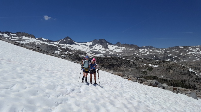
Princess Doah & Tiger Lily John Muir Trail June 29th ~ July 19th, 2016 Mather Pass
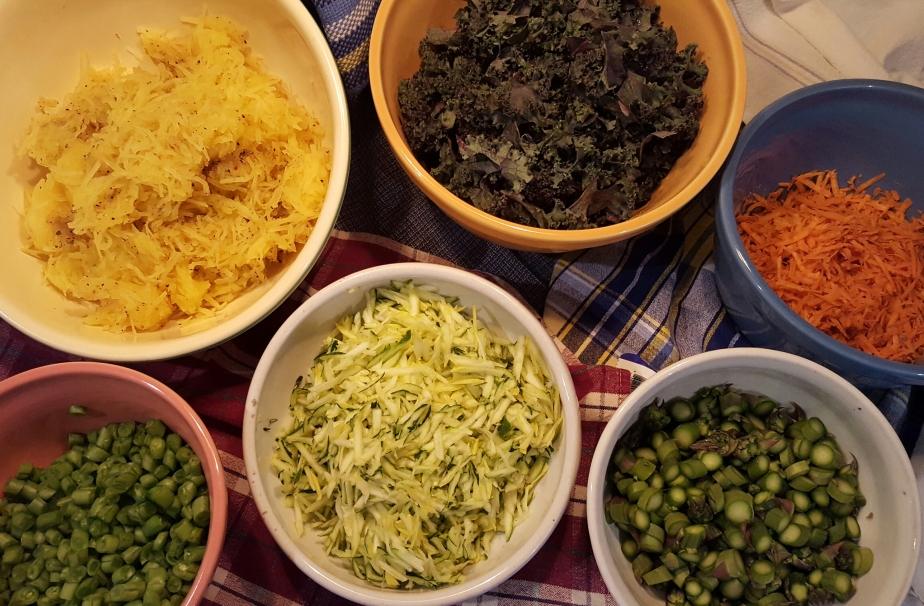
Having received a Dehydrator for Christmas this past year…Tiger Lily and I had it humming and drying all of our favorite fruits, vegetables, dinners and more…it was worth every bit of the time and effort we put into preparing our own home cooked meals for the trail! Yum!
One full portion per tray
Throughout the week at home I choose to eat a Dairy Free…Gluten Free…Grass Fed & Raw Organic diet…and for most of the time I eat Vegetarian. This hike was no exception to change any of my eating habits but with the daily consumption of additional proteins…Meat! For those who know me well enough, you know I may eat red meat (beef) at least once or twice a year. Pork/Bacon are a definite “No” in my diet but I do enjoy chicken, salmon and fish occasionally. Proteins are necessary to build and repair tissue. They are an important building block of bones, muscles, cartilage, skin and blood. Proteins were eaten all day long to help us sustain the journey.
Dehydrated Vegetables
JMT ~ Proteins ~ Diet
Salmon ~ Grass Fed Beef Jerky ~ Turkey Jerky ~ Nuts ~ Almond/Peanut Butter ~ Dehydrated White Chicken (added to dinners) ~ Beans ~ Quinoa ~ Oats ~ Wild Rice ~ Hummus ~ Dark Leafy Greens…all of this plus Protein Powders and Amino Acids in capsule form.
Our appetites waned those first several days but we always kept on track by eating a healthy robust dinner in large portions. If salmon or tuna were not eaten at lunch these meats were added to our dinner meals. We both noticed that anything sweet (chocolates, fruit bars, etc.) were less desired than the saltier foods…crackers, salted cashews, hummus, dried jerky. Our bodies were beginning to crave for more salts! Sodium is responsible for controlling the total amount of water in the body. It is also for regulating blood volume and for maintaining muscle and nerve function. Too little sodium is called hyponatremia and is the most common electrolyte disorder. Caused by severe diarrhea or vomiting the symptoms include headache, confusion, fatigue and muscle spasms. Tiger Lily sipped on additional electrolytes (Nuun Active Hydration Tablets) throughout the day mixed in her water while I chose to chug (Orgain Organic Hydration in Coconut or Berry) mine at lunch. Of course all of the electrolytes are important…Chloride, Potassium, Magnesium, etc. but Sodium was our main concern.
JMT ~ Sodium/Electrolytes ~ Diet
Electrolyte Powder or Tablet Form ~ Dried Jerky ~ Hummus ~ Pretzels ~ Crackers ~ Lightly Salted Nuts
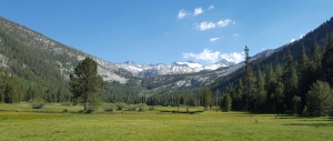
On Monday, July 11th we hiked a 13.9 mile day. From Rose Marie Meadow to Selden Pass and beyond the lakes were beautiful and the landscape displayed an array of different types of rock! Our packs were light, the day was sunny, clear and very pretty and it was time to pick up our next resupply at the Muir Trail Ranch.
Marie Lake 10,551′ One Hundred Miles Hiked Climbing Selden Pass
The Muir Trail Ranch is a 0.9 mile hike off of the JMT. Straight down which means a straight back up with an overly full load! We had mailed to ourselves a large 5 gallon bucket of toiletries and food items to get us through the remainder of the now 112 mile duration of the hike. We both had packed plenty of food for ourselves for the 9 days along with new batteries, toothpaste, toilet tissue, amino acid tablets, bandaids and more. We had 9 dinners, 9 days worth of snacks and lunch and 9 breakfast. We also shipped a special treat to consume upon opening…mine was a Chocolate Protein Shake along with a Chicken & Rice Soup and Crackers…Tiger Lily had near the same. BUT…the 2.9 pound 500 Bear Vault that each of us carried was in no way going to hold all of this new food! Every hiker ships too much food to themselves to pick up at the MTR (Muir Trail Ranch) and either ships it back home or places it in buckets set aside for other hikers to pick through and take. We opted to ship a box home…and in my hurried up gotta get this repacked before they close at 5:00pm…I shipped home a dinner…2 breakfast…several protein bars…crackers, cookies, camera, ball cap, used maps and guidebook pages, toiletries and much more. It just was not going to fit in my pack! I crammed everything back into my pack and hung my JetBoil stove outside the pack to carry. Ready…we left the Ranch at 5:20pm…they closed the gate and fastened it behind us. Two other hikers were approaching as we left and were turned away till tomorrow! Glad we made it!
Muir Trail Ranch Resupply
We had met a woman from Cincinnati while making our way to Mather Pass…she had decided not to hike to Whitney and was going to get off the trail two days early…which means she had too much food. She offered Tiger Lily and myself each a packet of Salmon, jerky with nuts and a Snickers chocolate bar…we knew that eventually we would both need this extra food provision and accepted graciously. God’s timing and her thoughtfulness were perfect! We parted never to see her again.
Patty & Tiger Lily Mather Pass
Mt Whitney was within days…food is getting low and I am portioning it out per day wisely. I prayed for more food to help provide the necessary nutrients needed. Within that morning a man approached us and ask our plans for summiting Whitney. He suggested that we tent at Guitar Lake and summit the next day. We explained our food situation…he offered to catch some fish for us and cook it up! By the time we reached Guitar Lake he was set up and excited to offer me some mashed potato flakes…I accepted. Just at the same time another couple (whom we had seen off and on for several days now) were passing us and got in on the conversation. They offered me two Granola bars and a huge bag of chili with noodles. Tiger Lily and I now knew how to plan the remainder of our hike…extra food had been provided…and it was “Just Enough”!
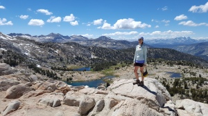
Mather Pass
God promises to provide us with our daily needs…thank you Father
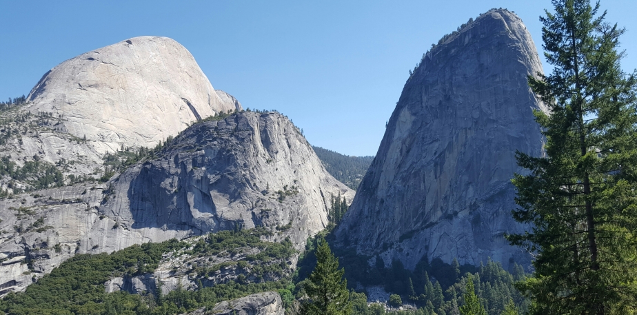
That Ole Half Dome Bear must have been mighty disappointed for she left without a nibble or a morsel to savor…and after two hours of clean up, taping and repairing our gear we were finally on trail that day at 3:00pm. Sunrise Creek was our tenting destination for that night. We didn’t make the mileage we had anticipated for that day but we did find a nice tent site near the creek. With 12 miles yet to hike before reaching the other side of the Valley, I looked forward to viewing the Cathedral Peaks the next day. The Cathedral Peaks were formed by glacial activity and are a part of the Cathedral Range which is a offshoot of the Sierra Nevada with an elevation of 10,916′.
Cathedral Peaks
John Muir called the Lembert Dome (pictured above) affectionately as “Glacier Rock”…she rises 800′ above the Tuolumne Meadows and the Tuolumne River. Although the John Muir Trail does not ascend this granite dome rock formation, it is many a rock climbers challenge to scale her face and for the first time near this junction now in Tuolumne…the JMT south bounders are in unison with the north bound Pacific Crest Trail hikers who are headed toward the Canadian border.
Cathedral Peaks from Tuolumne Meadows
Tuolumne Meadows is a popular resupply point for both trails. Equipped with a small supply store, post office, restrooms, hamburger Grille and a backpackers campground, this is a haven for many a weary hiker. We purchased more duck tape, super glue, Dramamine, fresh fruits and vegetables and picked up our resupply boxes at the PO. It was Saturday and they close at 4:00pm…we got there at 4:20…I knocked on the window and they had no problem retrieving our boxes for us. They even told me to come back in an hour if I wanted to ship a box out…they were super helpful and generous to the hikers! Being a holiday weekend they knew many a hiker was in need so they graciously accommodated! Although I just picked up a box of food…I shipped out a box of food back home. Mainly snacks and protein bars…I have not had a good appetite to speak of. The two electric strips in the store are full of the many hiker phones and cameras as others wait patiently their turn to plug in and recharge before moving on. Without a laundry room or a shower house…Tiger Lily and I proceeded to wash everything from head to toe along with our dusty clothes with tea tree oil and a bandana in the campground sinks.
Lyell Canyon
The second stage of this hike is to pick up our next permit which will take us from Lyell Canyon to Mt Whitney. We had received this permit months in advance by lottery and now the required time and day had arrived for us to obtain it. Each person that receives a permit of any kind will need to listen to the “Ranger Talk”…where they discuss Leave No Trace principles, campsite closures, National Park rules and regulations and they make sure each person is carrying a bear vault.
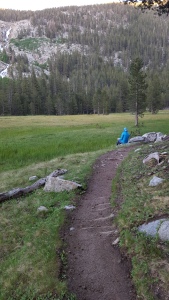
Lyell Canyon Sunday, July 3rd, 2016 Tent site
Having to take a day off to receive our permit, we were anxious to return to the trail…Lyell Canyon and Donahue Pass…
Approaching Donahue Pass
Upon reaching Donahue Pass…you exit Yosemite National Park and enter the Ansel Adams Wilderness. Donahue has an elevation of 11,066′ and is the 6th highest pass of the 10 total passes that the John Muir Trail will traverse. In our resupply boxes from TM…we had shipped to ourselves gaiters and Yaktrax to wear up and over the snowy passes…the gaiters nor the Yaktrax were needed and we gladly shipped it all back home from the next town we visited…Mammoth Lakes.
Looking NOBO Donahue Pass
The definition of a “Mountain Pass”…(also called a gap, saddle, or col) is a passage over a mountain range…they typically occur in valleys between mountain ridges, in low points along mountain watersheds or just the lowest point on a mountain ridge between two peaks.
Southside of Donahue Pass
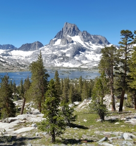
Once we have entered the Inyo National Forest & Ansel Adams Wilderness…we hike up and over our second pass…Island Pass…Tiger Lily eagerly awaits the viewing of the Thousand Island Lake with the majestic Banner Peak in the background soon after.
Thousand Island Lake Banner Peak
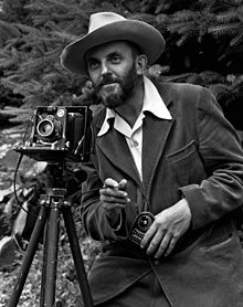
Ansel Adams was an American photographer. His black & white photographs of the American West and Yosemite National Park are widely popular…Tiger Lily herself is an accomplished photographer amongst family and friends. Her beautiful works of art and photos are proudly displayed in all of our homes. Ansel Adams black & white photograph of Banner Peak & Thousand Island Lake is stunning and Tiger Lily wanted to capture as many pictures herself of this majestic mountain and lake that Adams has made so popular.
Lyell Canyon Sunday, July 3rd Tiger Lily watercolor painting
Ansel Adams 1902 – 1984
Wildflowers…Majestic Mountains…Turquoise Lakes…Songbirds…Snow & Amazing Rock Formations…all in a day!
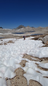
We were excited to begin our hike on the John Muir Trail! Stepping into the unknown…treasures to behold and mountains to explore. Snow covered passes, waterfalls, cascading rivers and steep, rocky mountains to climb! Warm days and cold nights…dry, dusty air with a touch of dizziness, headache, nauseated stomach…huffing and puffing down the trail! Take some Ibuprofen…ginger…Diamox…and drink lots of water! Still we felt the effects of hiking in higher altitudes…but nothing was going to stop us!
Nevada Falls
We hiked to the Little Yosemite Campground which is only 4.9 miles down trail. We saw our first momma bear and her cubs along with an occasional mule deer. Passing us up would be several mule teams over the first few days. One rider up front followed by 6 mules carrying their loads of supplies for the wilderness campgrounds.
Mule Team
We settled in to our campsite and later took a trip back to the Merced River to filter water and to bathe in its frigid cold waters. Later that evening the Park Ranger was making his rounds and checking permits. We had questions which he was very helpful to supply an answer. Our plan was to hike up the Half Dome tomorrow and we were going to leave our gear in the bear boxes and retrieve them later. The Ranger suggested that we just carry all of our gear and stash them at the base of Half Dome. This would save us an additional 3 miles of hiking. Sounded doable but what about animals getting into our gear I asked? He told us to separate all of the smelly toiletries along with the food and place it in our bear vaults. Hide the bear vaults in one area and the packs in another…”No problem” he said. It would be a Food Violation if we chose to do it differently. “No Problem”…
The trail toward Half Dome
We were on trail at 5:20am making our way to the turn off trail for the Half Dome only 1.5 miles away. We decided to carry our packs and do as the Ranger suggested. We hid our packs amongst some downed logs, took pictures to help locate them later and placed our bear vaults in another area. We know to put EVERYTHING that has any smell to it in the vaults! And we did!
Climbing Half Dome
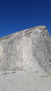
Half Dome is a popular granite rock to climb. She stands at 8,842 feet and bears the name Half Dome because of her domed shape. You reach what is called the Sub-Dome by climbing up rock stairs…a very steep climb for many. The final 400′ ascent is steeply up the rock between two steel cables used as handholds. Once on top you have a fairly flat surface to explore and take pictures . You can look down into the valley below or see for miles around. You must have good sticky, rubber type gloves to ascend and descend. They are a necessity! We ate a snack and walked on top for over an hour and a half…then time to go down! We decided to go down face first. Several were now coming up the cables and we descended down with ease.
On the Sub-Dome looking up toward the top of Half Dome
Descending Half Dome
From the top of the Dome it is 2 miles back to her base…where we had hid our gear. Tiger Lily had approached the packs first and said “It was not good”…the packs had been ripped open and all of our gear laid out in the open! Teeth marks on our Jet Boils…my water filter…teeth marks on my ball cap and on my tent…the sleeping bag that Tiger Lily was using had down feathers all over the ground…nearly every stuff sack had been ripped open…our brand new Thermarest NeoAir sleeping pads had holes…(Tiger Lily had to purchase a new one…and I get up several times during the night to blow mine back up…even after they have been patched and duck-taped) Teeth bite holes in some of our clothing…and our packs…well they are being held together with duck tape…
“No Problem”…
We were very thankful that our down jackets, rain jackets and my sleeping bag had not been touched. We were told later that when a bear is successful at receiving food…that behavior is repeated time and time again. It wasn’t that we had anything in our packs to lure the bear to it…it is that the bear at one time had successfully done the same thing and did find food. One example given is that there is a female bear in the area that will roll the bear vault to the edge of a cliff, kick it over and go retrieve the food from the cracked open vault.
Tiger Lily and I will press on…this is just a part of the adventure that may happen while out in the backcountry. We were not deterred by it! I always remember what a friend back home, a 2014 AT thru-hiker, “Rowdy” says…”No Adversity…No Adventure”…tis true!
Love to all…
The Double “D” Sisters…as in dehydrated and delirious…or that could be duck-tape and delirious!
When we get home we are going to have a “Gently Used Gear Sale”…just place your fingers over the bear teeth holes on my filter and she still works like a charm! Our packs will have traveled the John Muir Trail covered in silver and you will only have to blow up my air mattress a few times during the night to stay a float! lol lol lol
Flying into Oakland, California on Monday, June 27th we knew we were in for an adventure! A bus ride followed by the Amtrak train followed by a car ride from Uber into Yosemite National Park…we knew we were taking our chances by executing our plan. You see, when we were applying for our permits at the beginning of the year to hike the JMT we were unable to get a permit from Happy Isle to Mt Whitney…but…we did get our permits from Lyell Canyon (across the Yosemite Valley) to Whitney. We needed to mop up the first 27 miles which we did not have a permit for.
Half Dome ~ Yosemite Valley
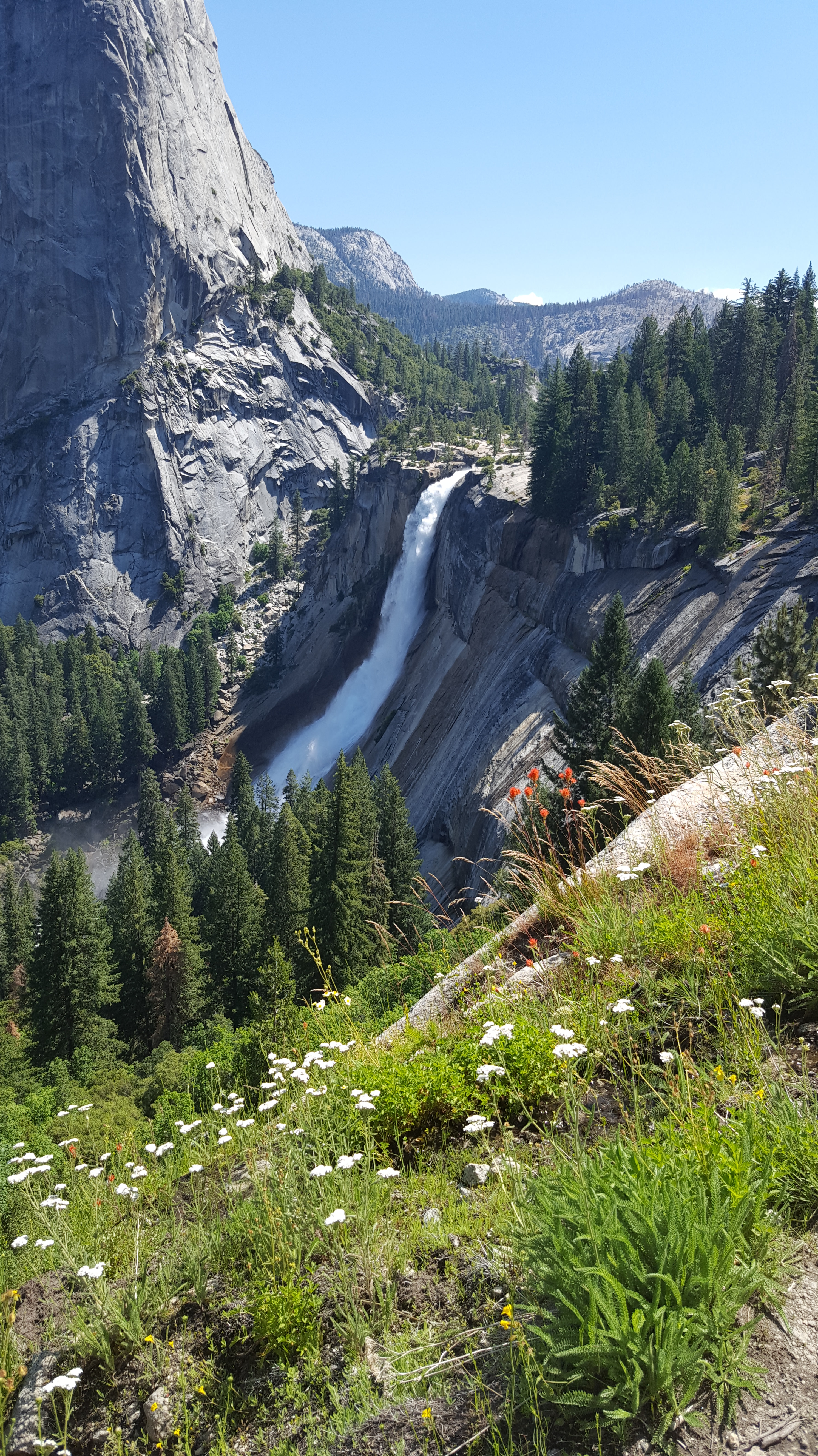
We had reserved a campsite for the first two days and on those days we hiked on the many local trails trying to become acclimated to the altitude. The Mist Trail is a popular trail that will take you up to Vernal Fall…a mere 1,000 foot climb! At 317 feet this beautiful waterfall pours over the rocky ledges into the Merced River.
Vernal Falls ~ Mist Trail
It was a long first day in the Valley. We got up at 4:00am so that we could hike down to the Wilderness Station to be first in line so that we could get our permits from Happy Isle to Lyell Canyon…plus we wanted permits to climb Half Dome. Dragging out our Thermarest pads with our sleeping bags we hiked in the dark…but, we were the first in line! So we decided to get more sleep and laid down on the ground only to be hastily awaken by a Park Ranger at 7:30am and with a very firm and loud voice…”No sleeping allowed”…that woke us up! At 8:00am they took our names and told us to return at 10:45am to apply for the permits. Since we were first in line we got our permits first…Happy Isle to Lyell Canyon along with Half Dome! YeeHaw! We were now ready to begin our hike of the John Muir Trail!
It was the year of 1976 when I flew out to San Francisco to explore the west coast and find a life for myself…a life that would take me venturing out amongst the high cliffs of the Pacific Ocean, or crossing the Golden Gate Bridge, taking a bus to the Mission district and shopping in all of the glorious thrift shops or sometimes traveling with a girlfriend named Mae. I met Mae along with her boyfriend and on occasion she and I would take off in her little raggedy car and drive up the coast towards Oregon. Stopping in quaint little towns…walking the beaches. At night we would sleep out under the stars and would return back to the city…beautiful San Francisco…to jobs, boyfriends and to establishing a home for myself.
I lived in what is known as the Haight Ashbury district. An area of town that had a hopping night life, flower children with flowers in their hair, barefoot hippies and music venues with well known artists…peace & love. The height of it all was now long gone…it was much quieter now in 1976.
Yosemite National Park is not far from the city of San Francisco just laying to the southeast. It was after all where the Redwood trees grew and that was something I wanted to behold…but alas…little did I know about altitude sickness! Taking in all of the magnificent sights of Yosemite during the day, when darkness fell within the park it was time to figure out where we would sleep for the night…so we pulled over on the road and slept in the car! I remember not sleeping much…I sickly stumbled out of the car…all night long! I now know it was due to the higher altitudes that I was not acclimated to. Now…40 years later, I will once again venture to San Francisco…this time I will travel by train to Yosemite National Park to explore this vast wilderness…by foot.
My sister, Tiger Lily and myself will hike the 220 mile John Muir Trail which begins within Yosemite at what is known as Happy Isles. We are fully equipped for this…meaning our packs are way too heavy! Gear I am not used to carrying on a backpacking trip…micro spikes, bug nets and a 2.9 pound bear vault to carry all of our foods and sweet smelling toiletries in an attempt to keeping the bears from stealing our grub!
I will try to write on this blog often and try to keep you on the edge of your seats while we climb Half Dome, ford Bear Creek, cross snowy and icy mountain passes and ferry over to the Vermillion Valley Resort. Stop by and read up on our adventure!
Oh yea…eating the spice of Ginger, keeping hydrated, day hiking a few days to allow ourselves to become acclimated and taking meds…anything and everything to calm down the altitude sickness. That monster is not welcome on this trip!
Anticipating a wonderful adventure with Tiger Lily,